

Geograhy of Block Panchayath & Map
Alangad Block Panchayat
Geographical Features and Ward Map
Local features rich in natural beauty and water resources along with the ward map
Ward Map
The official ward map of Alangad Block Panchayat is shown below. You can also use the link below to open it in a new tab:
Alangad Grama Panchayat
Alangad is a grama panchayat noted for its water abundance and agricultural heritage, situated in Paravur taluk of Ernakulam district. Its geographical location adjacent to the Periyar River and backwater network greatly influences the panchayat's agricultural sector and natural beauty.
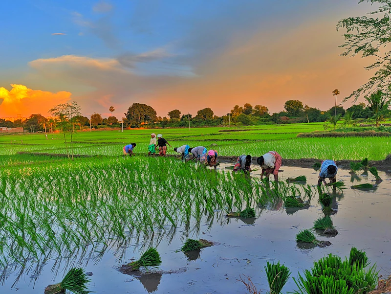
Location & Topography
- Part of Paravur Taluk
- Low-lying plains
- Flood-prone areas
Water Resources
- Periyar River basin area
- Streams, canals, and ponds
- Suitable for agriculture and fishing
Climate & Agriculture
- Tropical monsoon climate
- South-west monsoon availability
- Coconut, paddy, banana, and vegetables
Kadungalloor Grama Panchayat

Kadungalloor is a grama panchayat situated under the Alangad block in Paravur taluk. Due to its proximity to Aluva town, this region possesses a blend of urban-rural characteristics and a rich agricultural culture.
Geographical Features
- Mostly plain terrain
- Abundant water resources
- Paddy fields and backwaters
Climate
- Tropical monsoon
- South-West / North-East monsoon
- Humid and warm climate
Soil & Agriculture
- Alluvial soil
- Mainly paddy cultivation
- Banana, coconut, and vegetable farming
Varapuzha Grama Panchayat
Varapuzha is an important coastal grama panchayat within the limits of Alangad Block Panchayat. Situated in the lower reaches of the Periyar River, this region is famous for its water resources and traditional Pokkali cultivation.

Water Resources & Transport
The Periyar River and streams are suitable for water transport, fishing, and Pokkali cultivation.
Development & Lifestyle
Being plain land, it provides a favorable environment for agriculture, residential development, and trade activities.
Major Localities (18 Wards):
Karumalloor Region
The Karumalloor region is rich in vast paddy fields and is a major hub for paddy cultivation. Daily life here is closely intertwined with agriculture. Famous spiritual centers like the Purappillikkavu Temple are also located here.

Agriculture
Being a major center for extensive paddy cultivation, local life is closely connected with farming.
Cultural Centers
Prominent spiritual centers like the Purappillikkavu Temple are situated here.
Location
Shares borders with Alangad, Kottuvally, and Chengamanad regions.